Useful contacts, links, apps

This page provides contacts and links to Government departments and other peak bodies which give information on various aspects of bushwalking safety. It also suggests a number of apps that may be of interest to bushwalkers.

Emergency

Screenshot 2023-05-01 at 4.23.01 pm

Emergency phone number – Triple zero 000

Note that 112 may be used as an acceptable secondary emergency line from mobile phones. It connects to Triple Zero, but does not provide enhanced priority or other benefit. See clarification on the Australian Government website.

Screenshot 2023-05-01 at 4.21.09 pm

Emergency + (Emergency plus) smartphone app

The Emergency + app has been developed by Australia’s Triple Zero Awareness Working Group. One advantage is that it will display the GPS coordinates of the phone’s location that the caller can read out to the emergency operator.

Screenshot 2023-05-01 at 4.21.50 pm

VicEmergency website and app.

VicEmergency has a real time Google Map display with incidents across the state including fires, floods, storms, earthquakes, tsunamis, hazardous materials and traffic accidents.

The VicEmergency app provides Victorians with access to warnings and incidents for fires, floods, storms, earthquakes, tsunamis and water safety. It is available for download from the App Store, or Google Play

A VicEmergency hotline 1800 226 226 provides supplemental emergency information.

ios12-iphone-x-lock-screen-place-emergency-call

iPhone Built in Emergency button

Some smartphones have a built-in emergency app, for use without having to open the phone with the password.

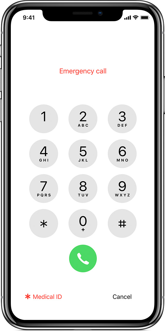
On the iPhone password screen, there is ’emergency’, enabling a direct emergency call and access to your pre-programed Medical ID information.

iPhone 14 models enable message emergency services even when there is no phone reception. The Emergency SOS feature works by connecting directly to satellites located more than a 1,000km from Earth.

iPhone 14 users can connect to the satellite by calling 000 in Australia, or 111 in New Zealand, and selecting the Emergency SOS button, or by holding the side button in tandem with the volume button.

The feature sends details of your emergency, location, iPhone battery level and Medical ID, if enabled, to Apple-trained emergency specialists who can communicate further via text with the person about their situation and whereabouts.

First Aid Kit

All walkers should carry an appropriate First Aid Kit

unnamed

First Aid app

Useful apps include

First Aid by St John Ambulance,
First Aid by Australian Red Cross, and
First Aid Fast.

first-aid-306058_1280

First Aid training

Bushwalking Victoria may provide a subsidy for recognised First Aid training.

3063206

Ambulance

Walkers should consider if they have appropriate insurance for ambulance transfer. Many people have some (often limited) cover through their personal health insurance. If not, or if the cover is limited, direct membership of Ambulance Victoria is recommended.

Fire

download

Victoria Bushfire Information Line – 1800 240 667

The Victoria Bushfire Information Line (VIBL) provides information about significant bushfires, bushfire risk, planned burning and related matters.

fire-ban

Fire Ratings and Total Fire Bans

Fire Danger Ratings are forecast for four days and a Total Fire Ban is declared by CFA as and when appropriate. MUAB automatically cancels a walk if a Total Fire Ban is declared in the relevant district on that day.

Weather

download (1)

The Bureau of Meteorology of Australia provides a comprehensive website.

Useful apps include Weatherzone Plus, Yahoo Weather, or you can access the Met’s own mobile website.

Bushwalking Victoria provides useful guidelines to Walk Leaders regarding planning and preparations for extreme weather events and other safety issues.

Related organisations

BWV-logo-plus-text

Bushwalking Victoria

Members of MUAB are automatically entitled to membership of the peak body Bushwalking Victoria, with the many benefits this confers. These include among others, access to the annual Federation Walks weekend, the directory of Victorian walksinsurance when participating in club activities, and discounts at some relevant retailers of bushwalking equipment and services. It is worth visiting the website to better understand the range of activities undertaken by BWV.

Bushwalking Victoria has also published an online Manual, with a wide range of information to increase safety and enjoyment for recreational bushwalkers, and which is particularly valuable for Walk Leaders.

nzmpXTmT_400x400

Parks Victoria

Parks Victoria manages over 4 million hectares of parks and related assets. It has a very comprehensive website to assist Parks users. Amongst many other services, it makes available maps for many of the parks, and park maps optimised for viewing on mobile devices are made available free of charge from Avenza PDF Maps app.

360_F_342649318_cAAaTFjbKvER9MmFueZxa1tPK7Y63pOV

Roadside Vehicle Assistance

Roadside vehicle assistance is worth considering if travelling by car to the location of walks. MUAB makes no representation as to the quality or suitability of any providers of retail goods or services, including the well-known RACV.

GPS Tracking Apps

4369874

There are numerous apps for GPS location and tracking available for smartphones and related devices, and MUAB does not review these, or recommend any particular apps as suitable for the requirements of individual walkers. However a number of MUAB walkers use such apps on their devices, and it is worth discussing with them what they have found to be the benefits and limitations. Note that some are free, and others require commercial purchase.

As described above, the Avenza PDF Maps app is useful for following park trails. Other apps in common usage are Map my Walk, myTracks, and Navionics Hike and Bike. A top of the range app, particularly useful when doing major self-guided walks, is Gaia Maps. Some enable you to download the maps before the walk, so that utility is not dependent on a phone signal while walking. You do however need battery power, and they can be heavy on battery use, so carrying a back-up battery pack is wise.

The best way to deal with the plethora of options, after discussion and a bit of research on what is available for your device, is to try them out and see what, if any, appeal to you. For those who enjoy playing with technology, it can be a lot of fun, as well as providing another layer of safety when out in the bush. They do not, however, replace good map reading skills and bushcraft, and should only ever be used as a secondary source of data, not least because of the likelihood of patchy connectivity when in the bush.

There are also dedicated GPS devices which some members may wish to consider for purchase. These provide a range of benefits well beyond what may be available through a smartphone. Anyone considering such a purchase would be well advised to undertake careful research through reputable sources.

As the MUAB Walk Leaders scope all walks prior to the event, general members should not feel the need to have GPS tracking apps or devices themselves, but only go down that pathway if they find the concept interesting and appealing.
Personal Locator Beacon

4726677-200

A distress beacon is an electronic device that, when activated in a life threatening situation, assists rescue authorities in their search to locate those in distress. A Personal Locator Beacon is the type used for bushwalking, or other remote area situations. PLBs communicate via a satellite system, and are independent of mobile phone connectivity. They are only for use in a genuine life-threatening situation.

MUAB owns a PLB, to be carried by the leader when scoping a trail or leading a group in a remote area.